Intertisement were contacted by Orbicon Informatics in 2015 with a simple question: “Can you help us visualize information on pipeline positions, depth and orientation etc. in relation to images of the real world?”. We accepted the challenge, based on our massive experience in visualization and Augmented Reality and created an exciting solution together.
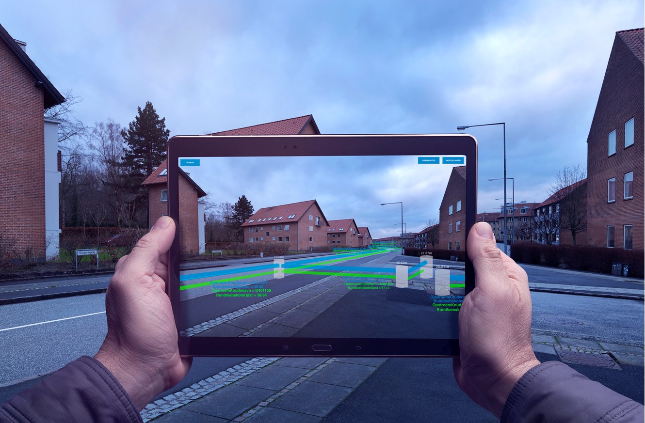
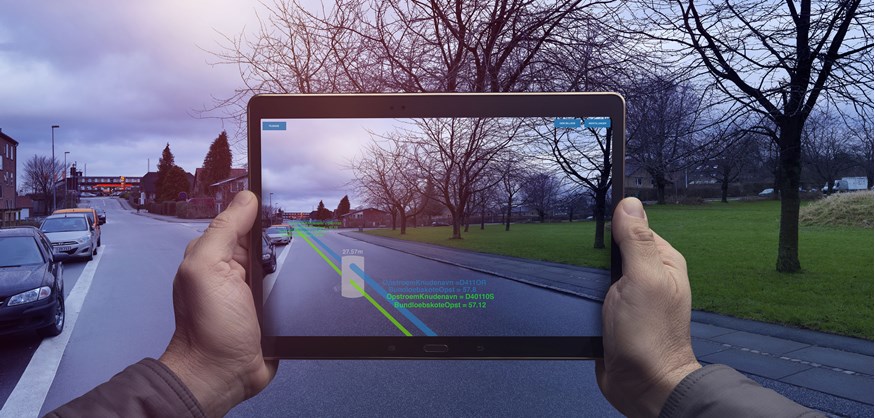
We are now able to load GEO datasets and visualize drainage pipeline information as an Augmented Reality overlay using a mobile device camera.
The initial version of the tool has been designed to work with the Samsung Galaxy Tab S (SM-T800), though it should be compatible with most Android based tablets currently on the market.
Using the device GPS, gyroscope and compass, we are able to plot data into a virtual 3D world in an approximation of the real position of the mobile device. Since we cannot yet estimate the elevation of the mobile device compared to the surface of the water, we use the nearest well in the loaded dataset to give the device an estimated elevation.
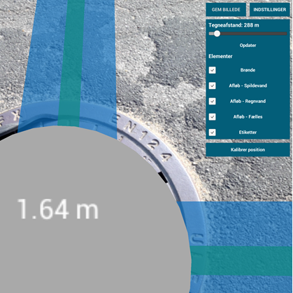
The pipeline information must be pre-processed and made available for download onto a device by using a web application. This skips the process of having the end-user manually put the datasets into the correct folder on a given device.
We will continue working with Orbicon Informatics on the tool in 2016, supporting more devices and adding new functionality.